Underfoot will be an app for exploring geologic, hydrologic, and pedologic (that's soil) maps. It is a hobby project I work on sometimes and it may never actually be finished, or even stable. It almost certainly won't be in the App Store or the Play Store because who needs the hassle.
Take a Look
Try it Out
Have an Android device? Do you trust me? Ok with the possibility that the app might crash and/or stop working at any time? Then you can try it out:
Open the APK and install
If you use Google stuff, Google may say the app is "Blocked by Play Protect." Choose to "INSTALL ANYWAY" (again, only if you trust me)
When the app opens you should be prompted to choose a download. Find one that looks good to you, download it, and check the mark to the left of it.
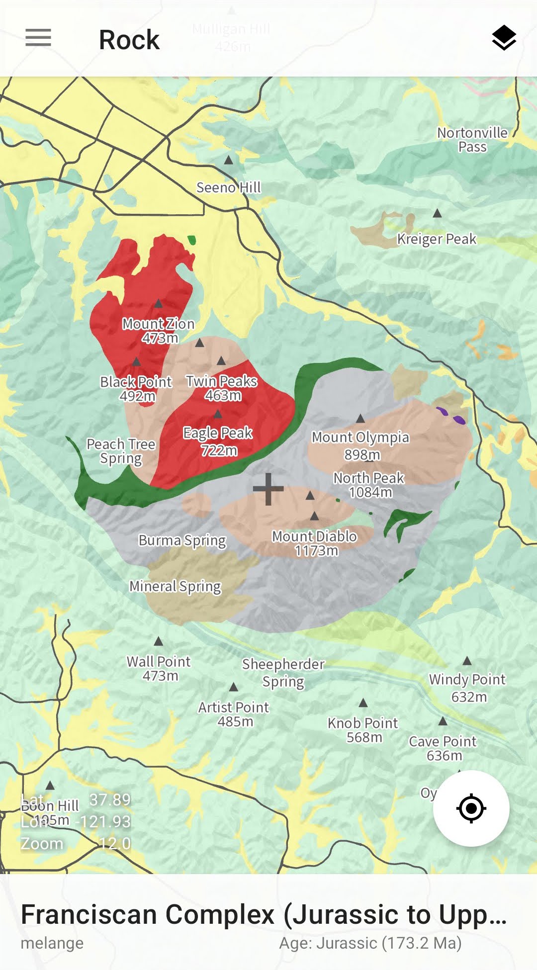
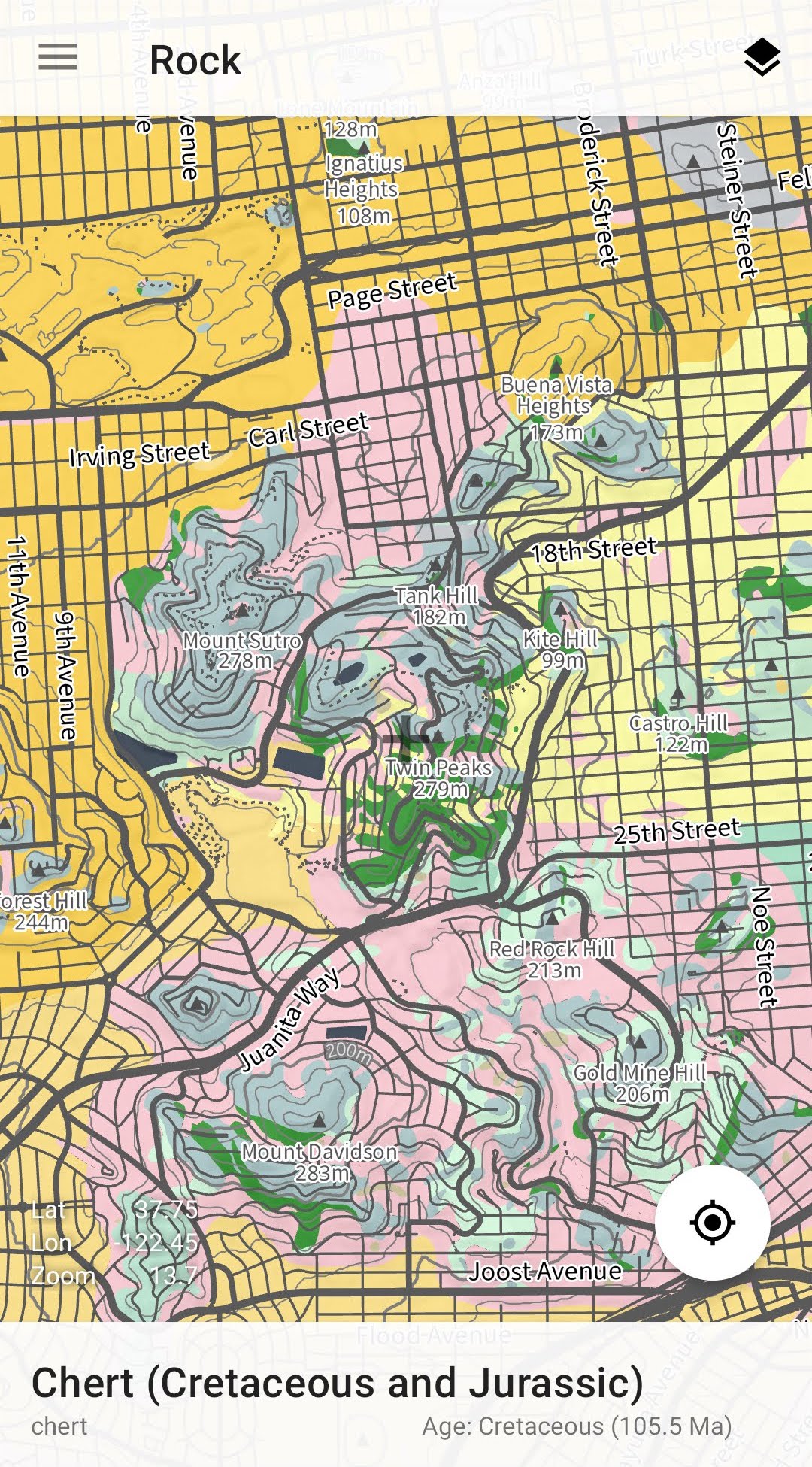
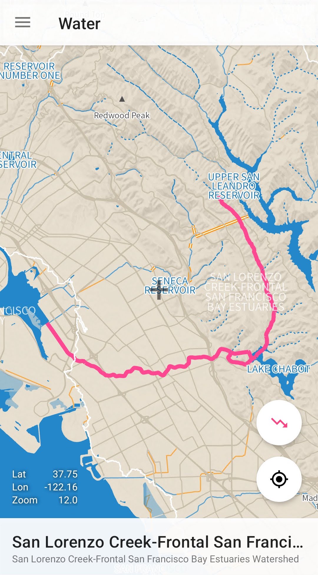
Navigate to "Rocks" or "Water." If might crash, but it should work when you open again (like I said, hobby project)
You'll probably need to pan the map or use the current location button to find the data (ok, legitimately embarassed by this part)
But How?
The app and the data tooling are open source, so feel free to take a look. Not pretty but it sort of works.
The data is almost entirely free and open, the bulk of it paid for by tax-payers in the United States (like me) and prepared by superheroic experts at the USGS. Here's a short list:
USGS geologic maps. Amazing stuff. Please digitize more, USGS!
NHDPlus HR. That's National Hydrography Dataset, also from USGS.
OpenStreetMap data hosted at GEOFABRIK. This is where all the streets, peaks, ridges, and springs come from. Best thing on the Internet after Wikipedia.
Mapzen Terrain Tiles, hosted by the Amazon Open Data Sponsorship Program. Using this for the contour lines.
Nextzen Terrain Tiles. Currently using it for the hillshades, online-only.
Too Boring? Too Many Steps? Who Is This Weirdo?
Understandable. Here's a pic of some rocks I took instead:
